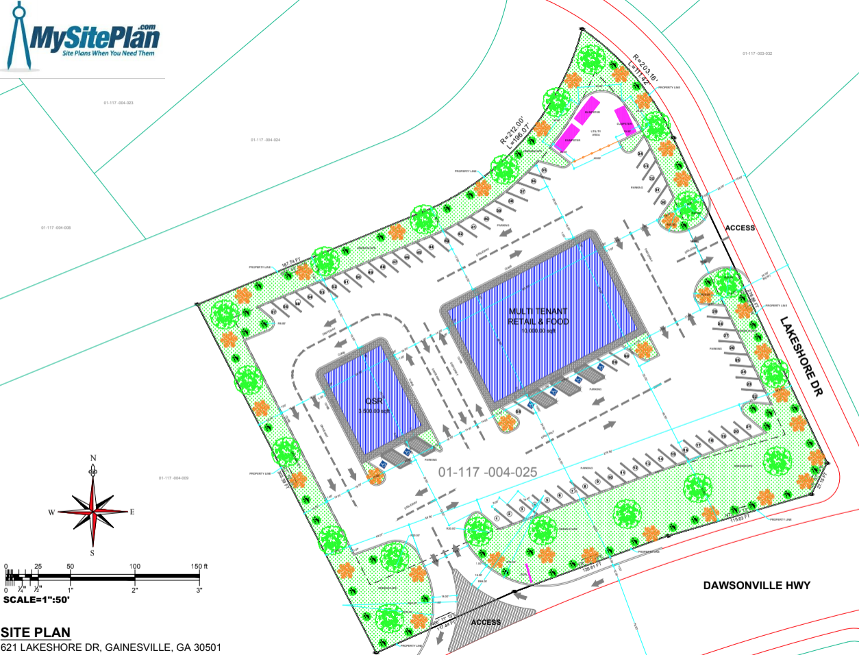
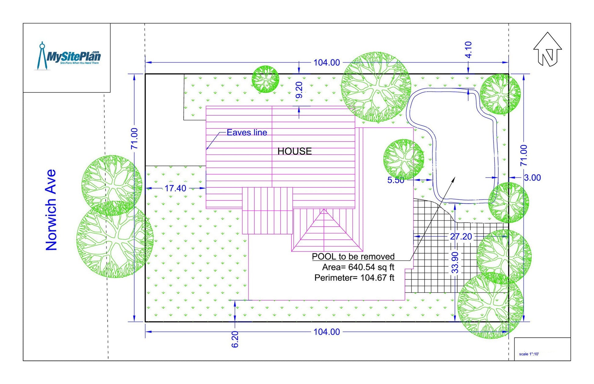
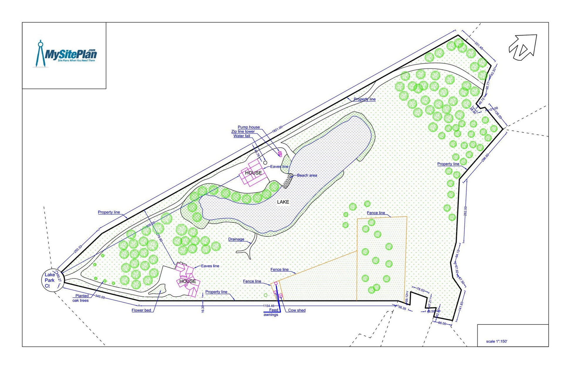
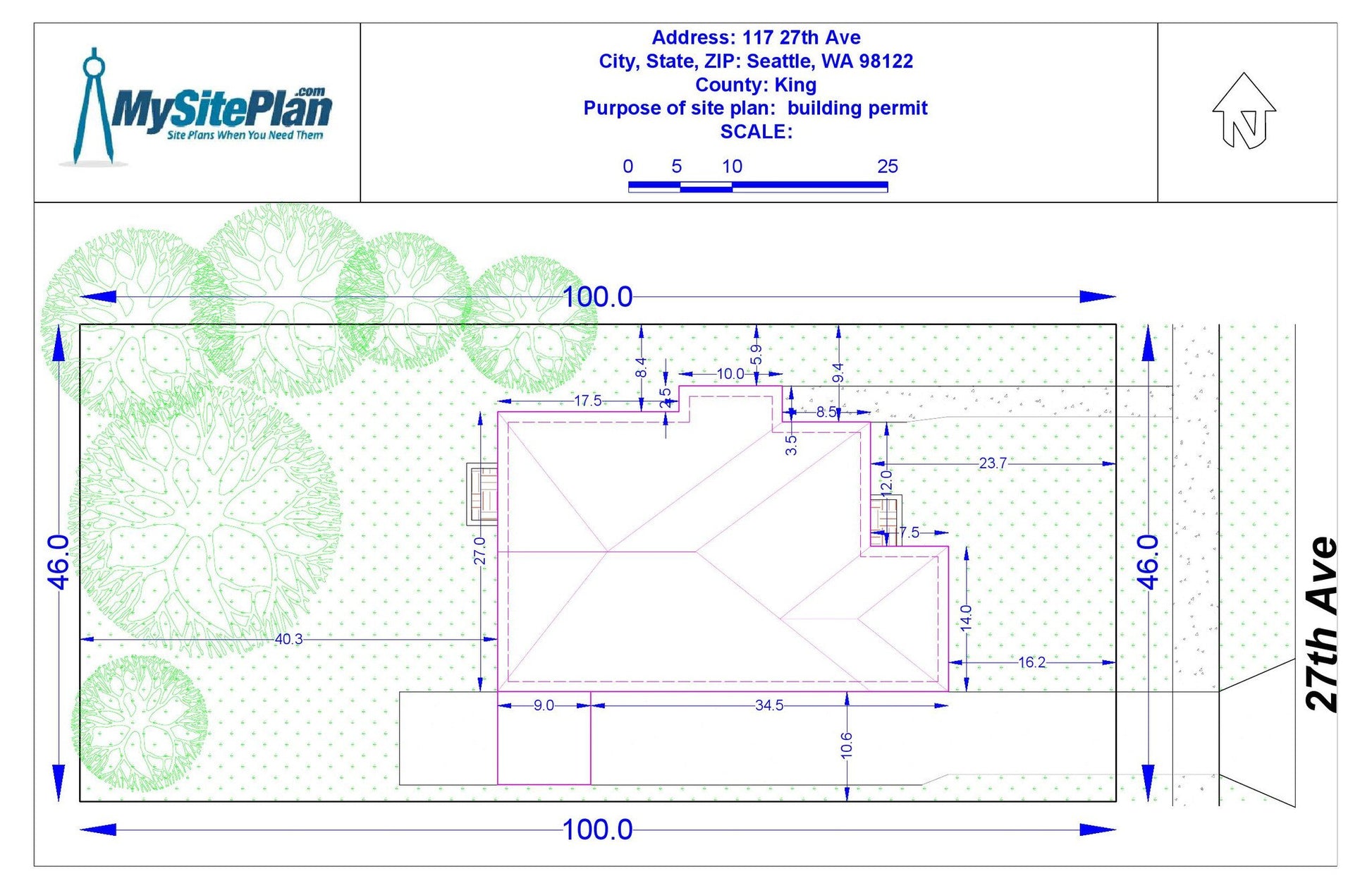
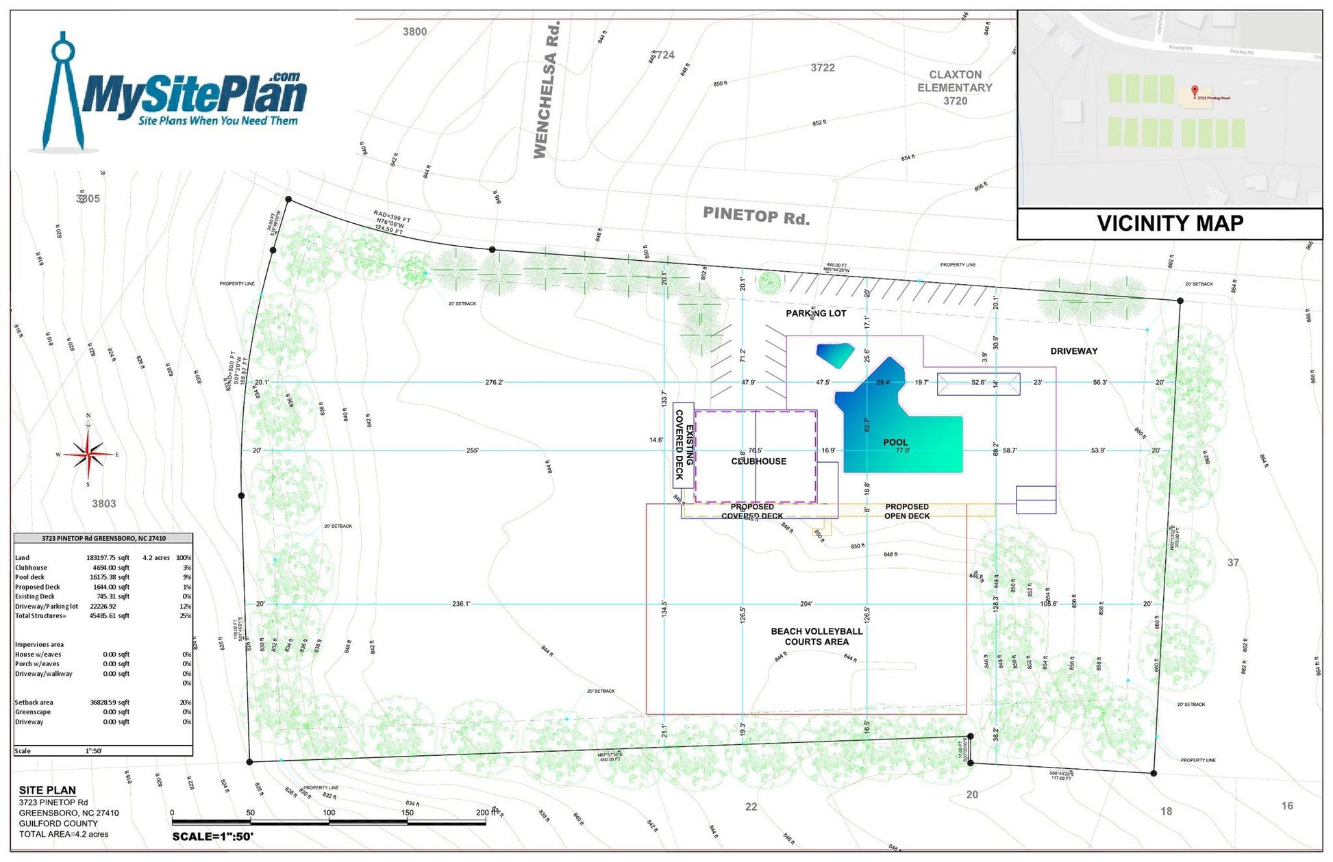
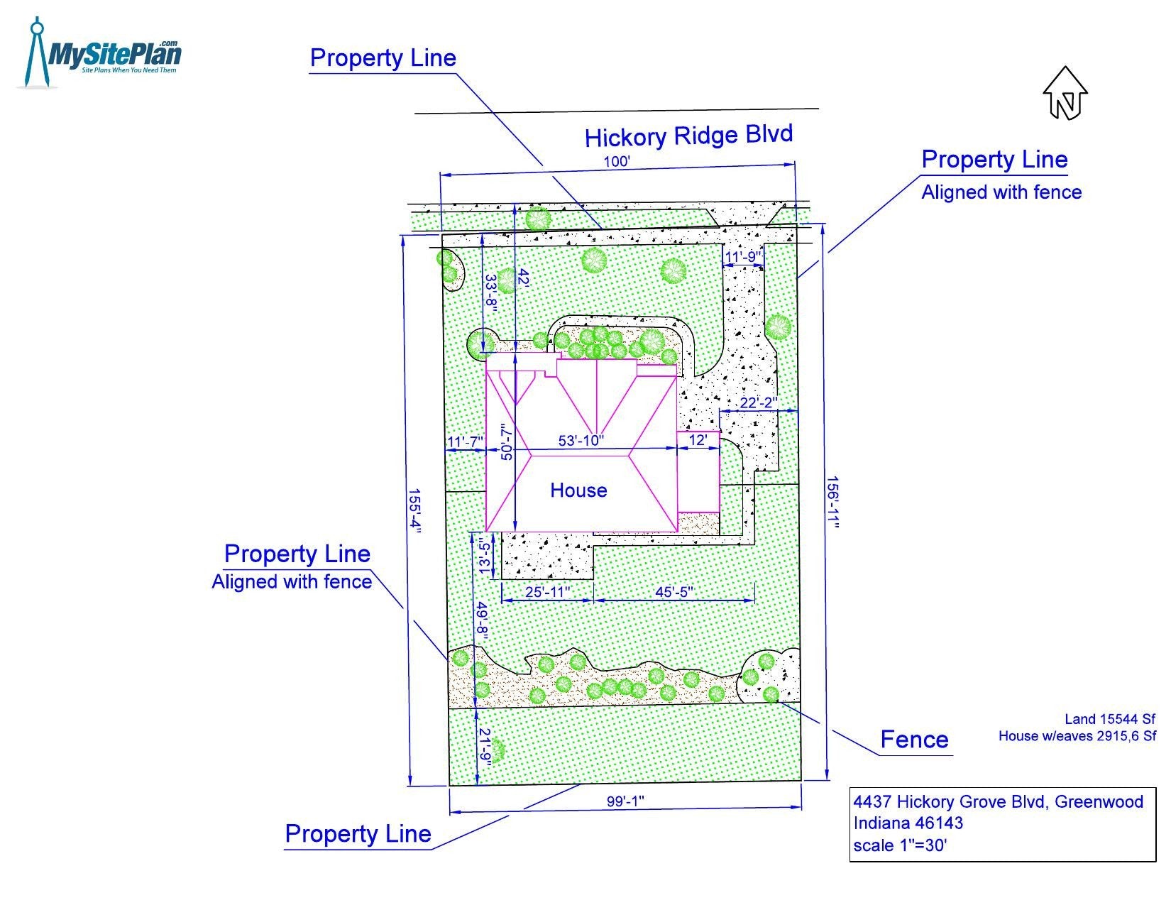
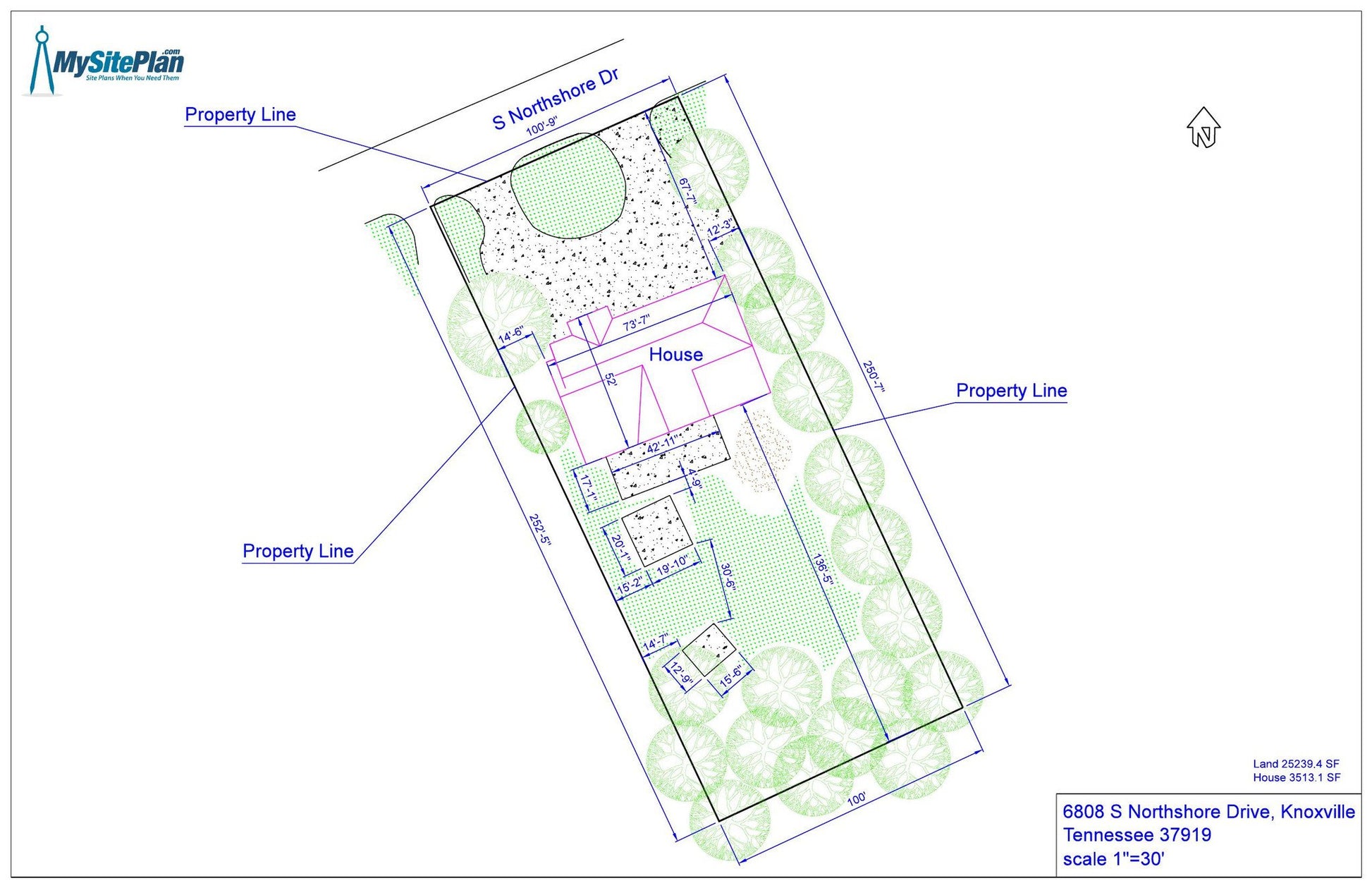
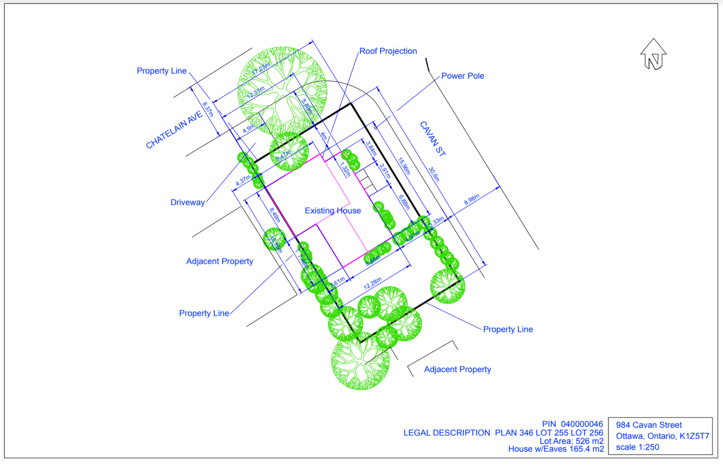
Overview
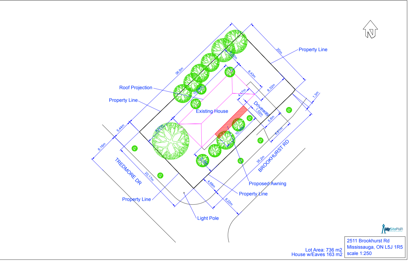
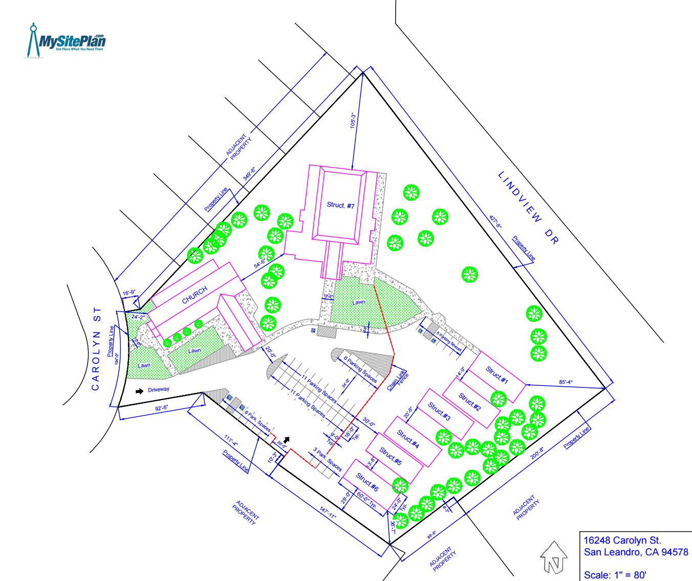
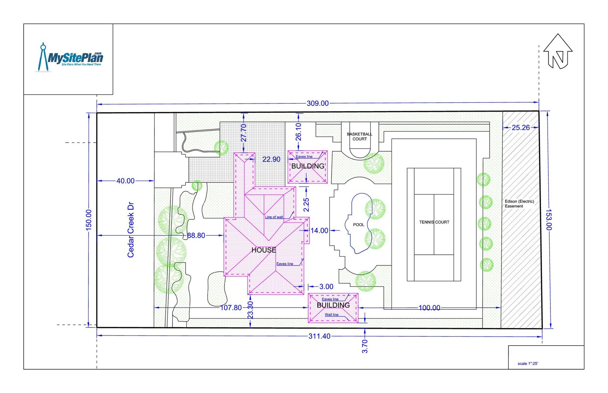
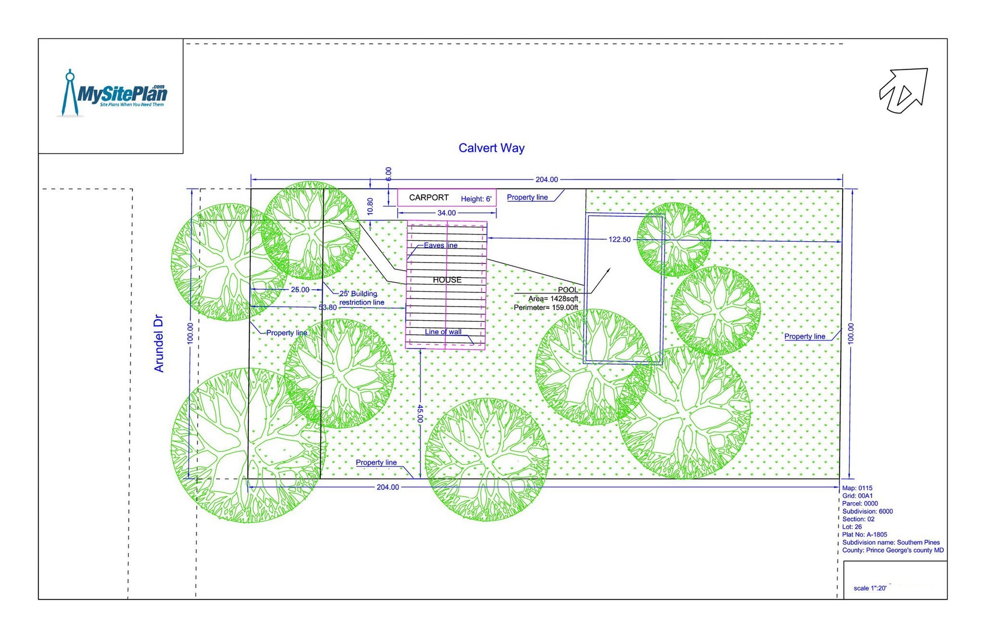
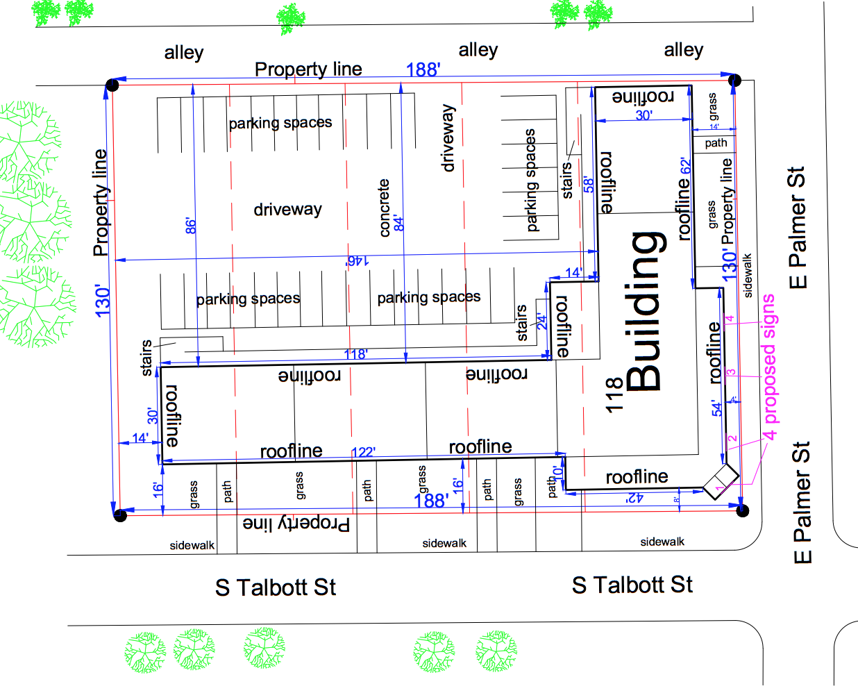
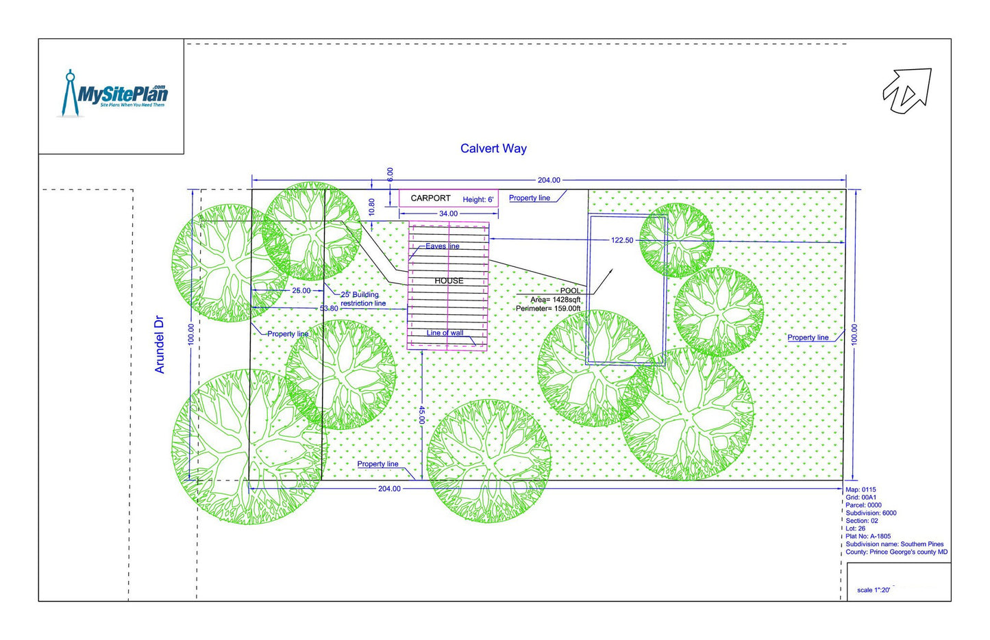
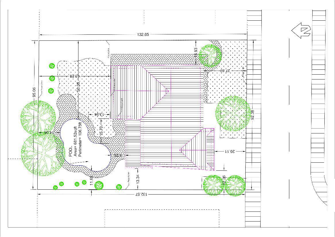
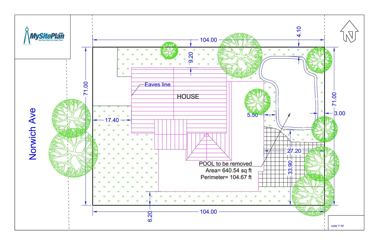
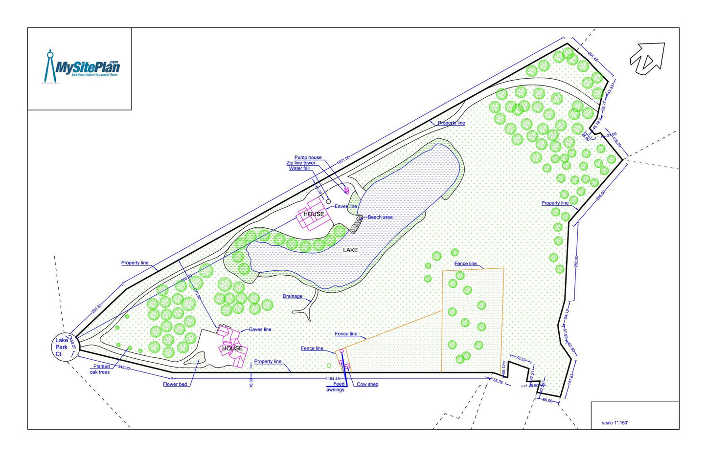
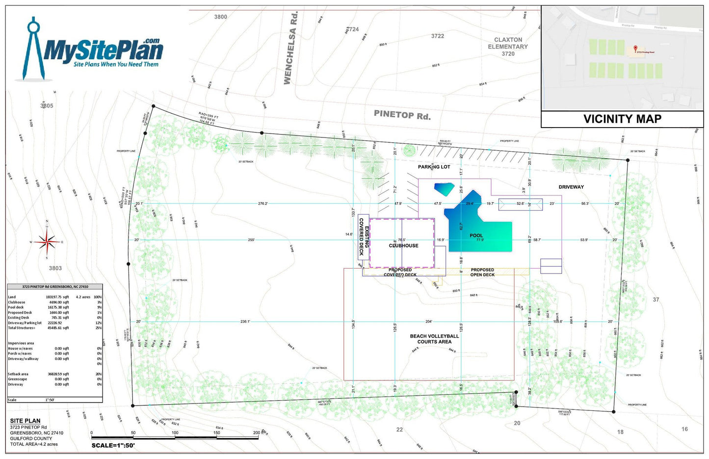
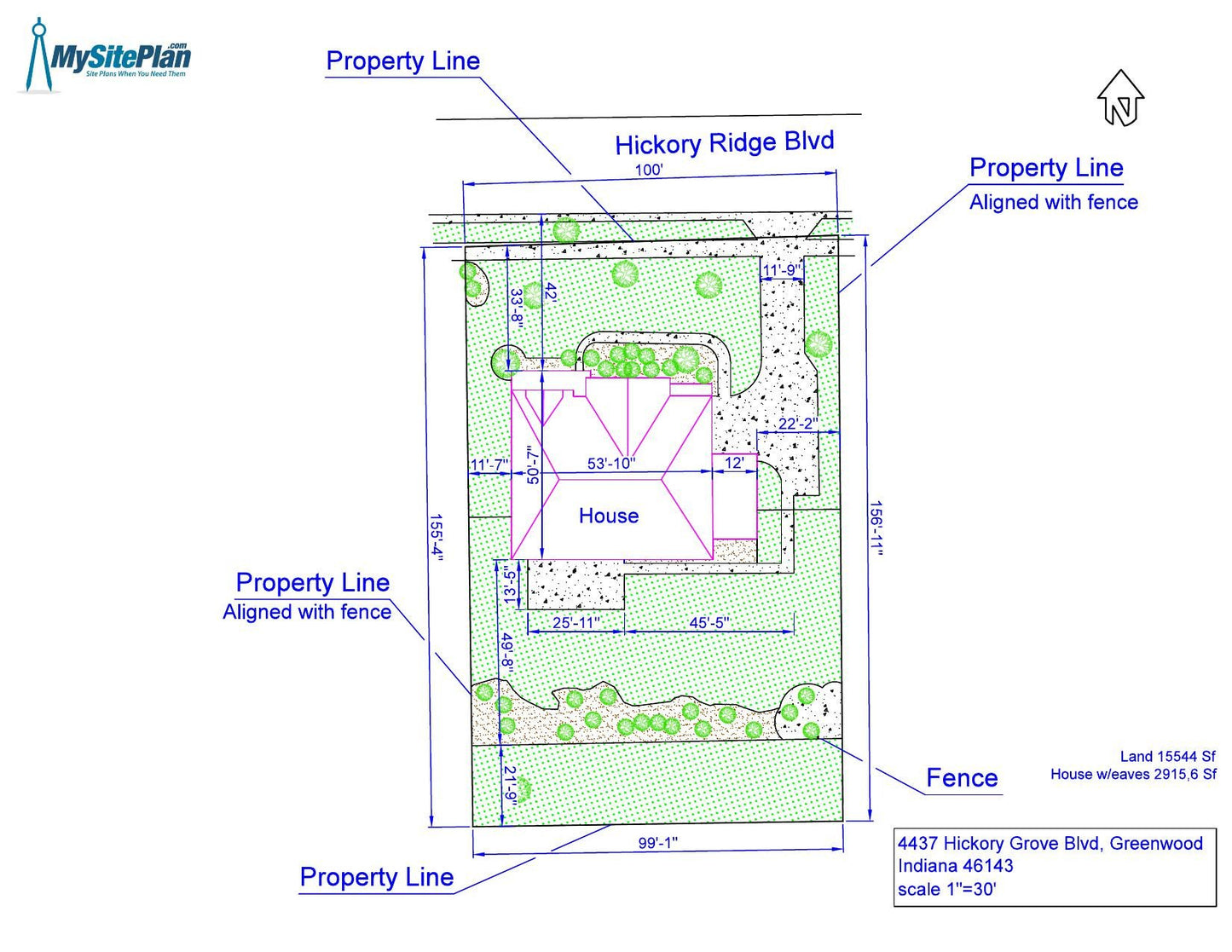
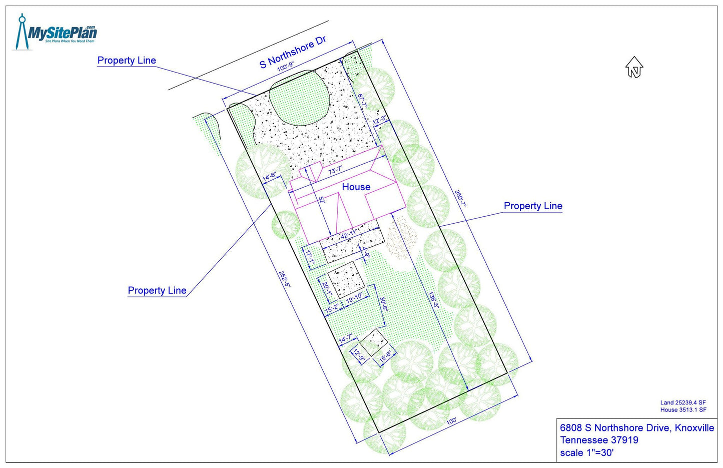
Our detailed site plan offers a higher level of detail for both residential and commercial properties. Using the latest satellite imagery, county parcel maps, and GIS technology, we will draw a comprehensive site plan of your property. This detailed plan will showcase all existing landscaping features visible via satellite, including structures, driveways, pathways, patios, gazebos, grass, trees, swimming pools, sheds, and parking spaces. Our only limitation is tree cover or recency of satellite imagery. If we miss anything, just let us know and we'll add it free of charge.
Uses
Our detailed site plan serves various purposes, especially when applying for building or demolition permits, conditional use permits or any other permit where the permitting department needs to see a higher level of detail. Whether you need a permit for a new outdoor structure or for demolishing your house, or showing your parking spaces, this site plan will support your application process.
Additional Information
The detailed site plan covers up to 3 acres. If your property is over 3 acres, please reach out to us to verify the pricing details. Additionally, it is important to confirm with your local building department whether they require a surveyor, architect, or engineer to prepare your site plan. As a drafting firm, we do not stamp, sign or seal plans. However, our professional team will ensure that your site plan meets the requirements of your permitting process.